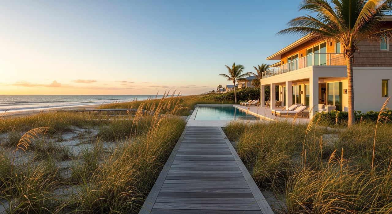
Buying a Merritt Island waterfront home should feel exciting, not confusing. Yet many buyers discover late in the process that the right to access and use the water is not automatic. If you want a private dock, a boat lift, or a seawall, you need to understand Florida riparian rights and how they work on the island. This guide breaks down the essentials in plain English and points you to the agencies that regulate docks and shorelines so you can buy with confidence. Let’s dive in.
Riparian rights in Florida
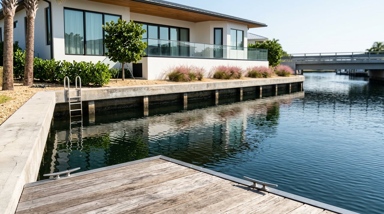
In Florida, riparian rights generally apply when your upland property touches a river, lagoon, canal, or bay. Your ownership usually stops at the shoreline, often the mean high water line. Waterward of that line, the State of Florida typically owns the submerged lands in trust for the public. You may have rights of reasonable access, the ability to wharf out for navigation, and potential benefits from gradual shoreline changes. Those rights are subject to the public trust and permits.
The state manages activities on sovereign submerged lands, including private docks and piles. You will often need authorization and permits before you build, expand, or replace waterward structures. For background on state ownership and authorizations, review the Florida Department of Environmental Protection guidance on sovereign submerged lands and the Florida Statutes, including Chapter 253 on state lands and Chapter 161 on coastal regulation.
Why Merritt Island is unique
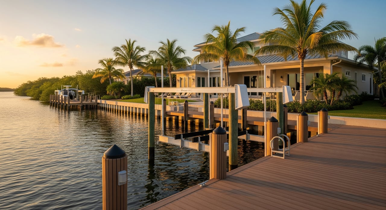
Merritt Island sits between the Indian River Lagoon and Banana River, both sensitive estuaries. Many parcels are tidal and adjacent to seagrass, manatees, and other protected resources. That means more careful permitting and design for docks, lifts, and seawalls.
Shading over seagrass, pile placement, and navigation conflicts are common points of review. The public also retains rights to use navigable waters for activities like boating and fishing. For local habitat context, explore the Indian River Lagoon National Estuary Program. To understand manatee protection and speed zones, see the Florida Fish and Wildlife Conservation Commission.
Who regulates your project
Several agencies may be involved in Merritt Island waterfront work:
- Federal: The U.S. Army Corps of Engineers regulates work in navigable waters. Many docks and lifts require federal authorization. Start with the Jacksonville District Regulatory Division.
- State: FDEP and the Board of Trustees oversee sovereign submerged lands authorizations and coastal permitting. Review FDEP’s pages on sovereign submerged lands.
- Regional: The St. Johns River Water Management District handles environmental resource permitting for certain activities. See SJRWMD’s ERP guidance.
- Local: Brevard County reviews building codes, shoreline setbacks, and related approvals. Visit Brevard County Planning and Development for local requirements.
What usually needs a permit
Expect permits or authorizations for most waterward work, including:
- New fixed or floating docks and any expansions
- Boat lifts and davits
- Seawalls, bulkheads, revetments, and shoreline stabilization
- Dredging of basins or channels
- Placing fill or piles in wetlands or submerged lands
- Major repairs that change the footprint or extend farther waterward
Some small, low-impact projects may qualify for streamlined approvals. When in doubt, ask agencies early.
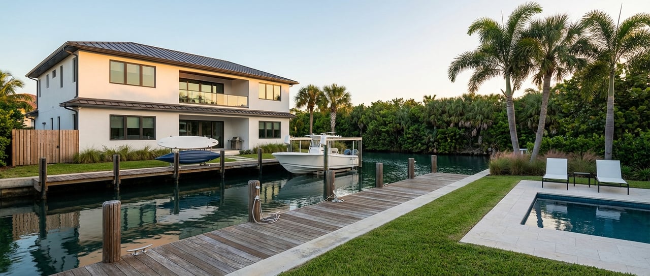
Dock and shoreline options
Understanding typical structures helps you plan:
- Floating docks: Flexible where conditions allow. Often still require authorization and careful mooring.
- Fixed pile-supported docks: Common for reliable access. Permitting is more detailed, especially near seagrass.
- Boat lifts: Reviewed for footprint and shading. Lift canopies can face extra scrutiny over habitat.
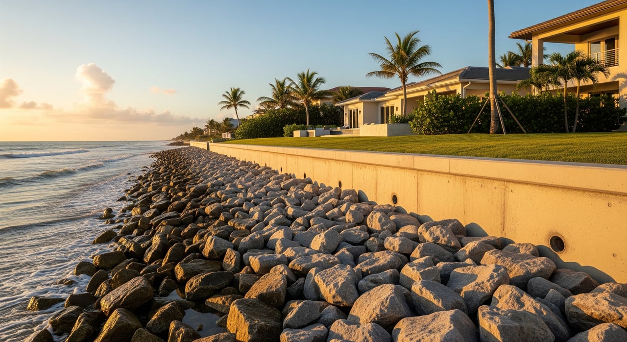
- Seawalls and bulkheads: Heavily regulated and may trigger mitigation. Living shorelines are often encouraged where feasible because they support habitat and can ease permitting in some cases.
Buyer due diligence checklist
Use this short list to protect your access and value before you close:
- Title: Ask for a title commitment that shows any recorded riparian rights, easements, or leases. Confirm whether any rights are shared or reserved.
- Survey: Get a recent boundary survey showing the mean high water line or ordinary high water line and any encroachments.
- Existing permits: Request copies of all state, federal, regional, and county permits, plus any sovereign submerged lands leases or easements, and as-built drawings.
- Compliance: Confirm that existing docks, lifts, or seawalls match permitted plans. Unpermitted work can require costly fixes or removal.
- HOA and neighborhood rules: Review covenants for dock dimensions, lift limits, and use rules.
- Depth and access: Verify water depth at mean low tide, bridge clearances on the route to open water, and any no-wake or seasonal restrictions.
- Environmental constraints: Ask about seagrass, oyster bars, wetlands, and manatee zones. Expect surveys or mitigation where sensitive resources exist.
- Flood and insurance: Check the FEMA flood zone and obtain an elevation certificate if needed. Ask your insurance broker about dock and lift coverage.
- Structural condition: For existing structures, hire a marine surveyor or engineer to inspect.
- Long-term risk: Discuss sea-level rise and shoreline change with qualified professionals. The NOAA Sea Level Rise Viewer can help you frame the conversation.
Common buyer scenarios
Here are examples of what we often see and how to respond:
Existing but unpermitted dock
- Require seller disclosure and copies of all permits. Order a survey and check with FDEP, USACE, SJRWMD, and Brevard County for any violations or open cases. Consider legal counsel experienced in coastal property.
New private dock with boat lift for a larger vessel
- Verify depth, route to the ocean, and bridge clearances. Ask about seagrass under the proposed footprint. Plan a pre-application meeting with FDEP, USACE, and the County. A coastal engineer and bathymetric survey can save time.
Canal lot with shared dock or deeded access
- Confirm recorded easements, maintenance obligations, and use rules. Shared facilities can limit individual dock rights and add cost-sharing duties.
Oceanfront vs lagoon parcels
- Oceanfront parcels often involve coastal construction setbacks and sea turtle considerations under state rules in Chapter 161. Lagoon-side parcels focus more on sovereign submerged lands, seagrass, and navigation.
Timelines, fees, and ongoing responsibilities
Plan for multi-agency reviews to take several months or more, especially if dredging, seagrass mitigation, or federal coordination is involved. If your dock occupies sovereign submerged lands under a lease or easement, you may owe recurring fees and must maintain compliance. Owners are typically responsible for repairs, safe conditions, and any removal if a structure harms navigation or fails.
How to move forward with confidence
A clear plan, the right documents, and early talks with agencies will help you protect your boating lifestyle and your property value. If you are evaluating a Merritt Island home or lot, our team can help you coordinate surveys, gather permits, and connect with respected coastal engineers and marine contractors so you can buy with certainty.
Ready to explore the right waterfront fit on Merritt Island or across the Space Coast? Connect with Jamie Dandridge for concierge guidance grounded in third-generation local expertise and backed by Sotheby’s global reach.
FAQs
What are Florida riparian rights for Merritt Island waterfront?
- They are upland owner rights like reasonable access and potential wharfing out, limited by the state’s ownership of submerged lands, public trust uses, and required permits.
Do I automatically have the right to build a dock in Florida?
- No, most docks require state authorization and often federal, regional, and county permits, especially when occupying sovereign submerged lands or affecting navigation or habitat.
Who issues dock permits on Merritt Island?
- USACE regulates federal approvals, FDEP oversees sovereign submerged lands and state permits, SJRWMD handles certain environmental resource permits, and Brevard County manages local codes.
How do manatee protection zones affect boating near my home?
- Zones can set speed restrictions and seasonal limits that affect routes and travel times; check FWC’s manatee protection guidance for local rules and maps.
What should I ask a seller about an existing dock or lift?
- Request all permits, leases, as-built drawings, and proof of compliance, plus any enforcement notices or required remediation.
Will sea-level rise change my dock or shoreline over time?
- Gradual change can affect shoreline positions and future design needs; use the NOAA viewer to discuss resilience options with engineers and contractors.